Seventy years ago, today, on April 8, 1942, a great earthquake took place (apparently magnitude 7.5), on the eve of the surrender of our forces in Bataan: and you can read about it in a young officer’s Bataan War Diary.
Continuing on my blog entries on the use of old maps, photographs, data, and even photographs and combining them with Google Earth to help visualize World War II in the Philippines, let me turn to a theme.
One of my favorite themes is the Landscape of Memory, which comes from a book by Simon Schama. Our penchant for renaming streets, and demolishing landmarks, robs us of the ability to situate past events in our present landscape. Maps from the past can, in a sense, restore that lost landscape, showing us where shorelines used to be, or what streets were called at the time. Overlaying old maps on Google Earth also helps us visualize, in a sense, the locations portrayed in those maps, and lets us compare and contrast those locations as they appeared –or were mapped, then– and how they appear, now.
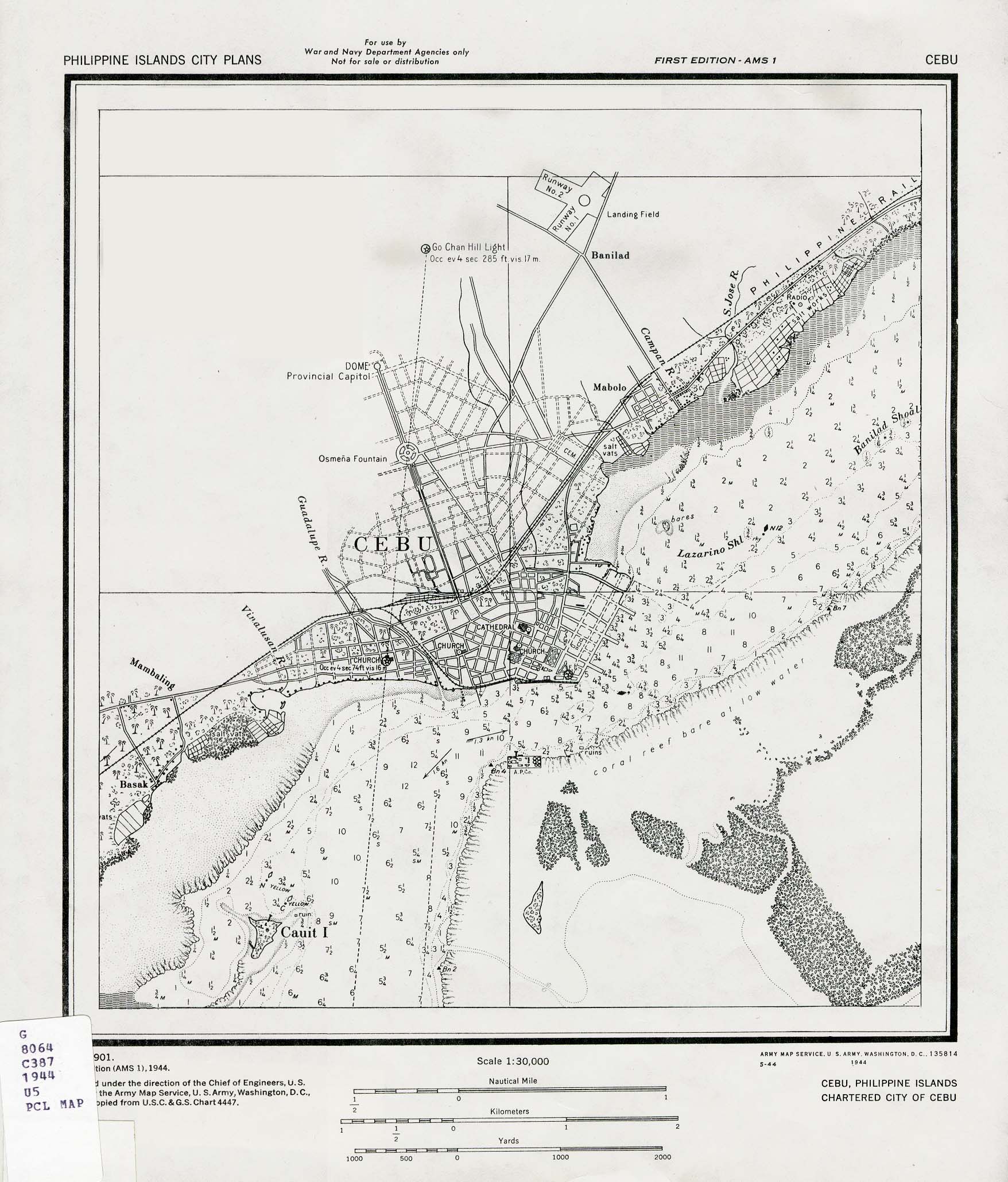
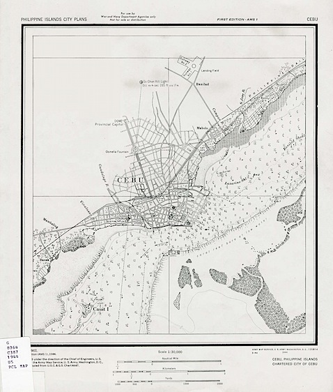
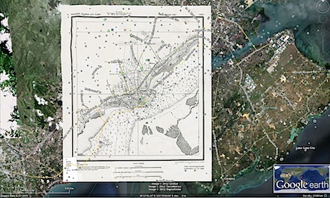
Take this map, prepared for the use of American forces in 1944, in the Perry Castañeda Map Collection.
One can easily overlay it on present-day Cebu City, as shown in Google Earth.
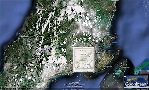
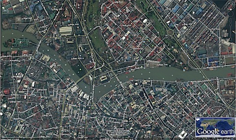
That’s pretty nifty on its own; but you can also look at present-day Cebu City:
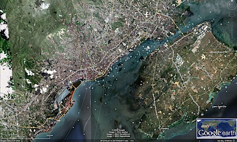
And compare and contrast Cebu City in 1944, with Cebu City today.
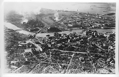
What can be done with maps, can also be done, to a certain extent, with historical photographs. Aerial photos from military reconnaissance would be the best match, if taken from directly overhead. But even photos taken at an angle can be overlaid on Google Earth to remarkable effect. Take this photo. It shows Manila, from a vantage point over Quiapo-Santa Cruz-Binondo, looking toward the Post Office Building. Behind the Post Office you can see smoke rising from the vicinity of Manila City Hall (left) and Intramuros (center).
Going to Google Earth, you can find that vicinity, more or less, as follows:
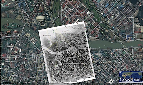
Aligning the historical photo and distorting it a bit, to make landmarks fit, leads to this remarkable result: you can better visualize the devastation, in the context of the surrounding area –and the Manila of today.
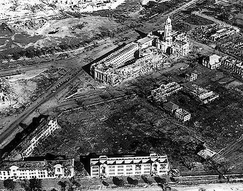
Take this truly remarkable photo, showing Manila City Hall (the side to your right is totally smashed, this was the side the Americans approached the building), with the pulverized Legislative Building leftmost, and the Philippine Normal College buildings at the bottom of the photo.
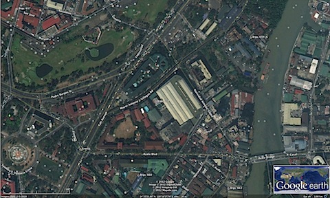
On Google Earth, you can find this same location: the green-roofed, coffin-like building is Manila City Hall, and to its left, the red-roofed Legislative Building (now the National Gallery of Art of the National Museum).
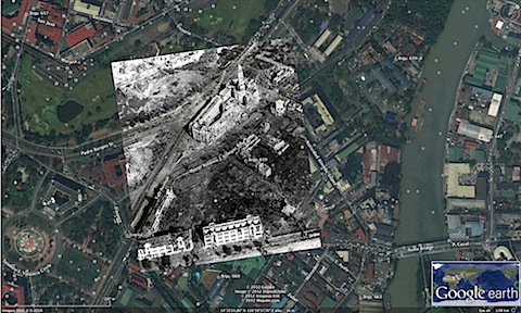
Overlaying the 1945 photo on present-day Manila leads to this haunting juxtaposition:
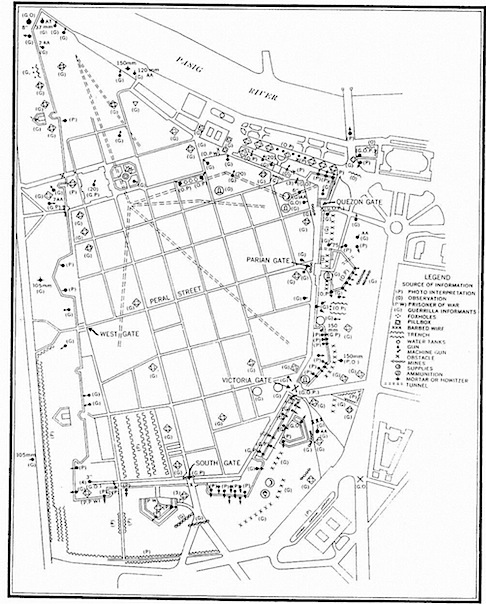
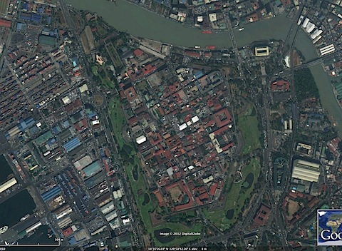
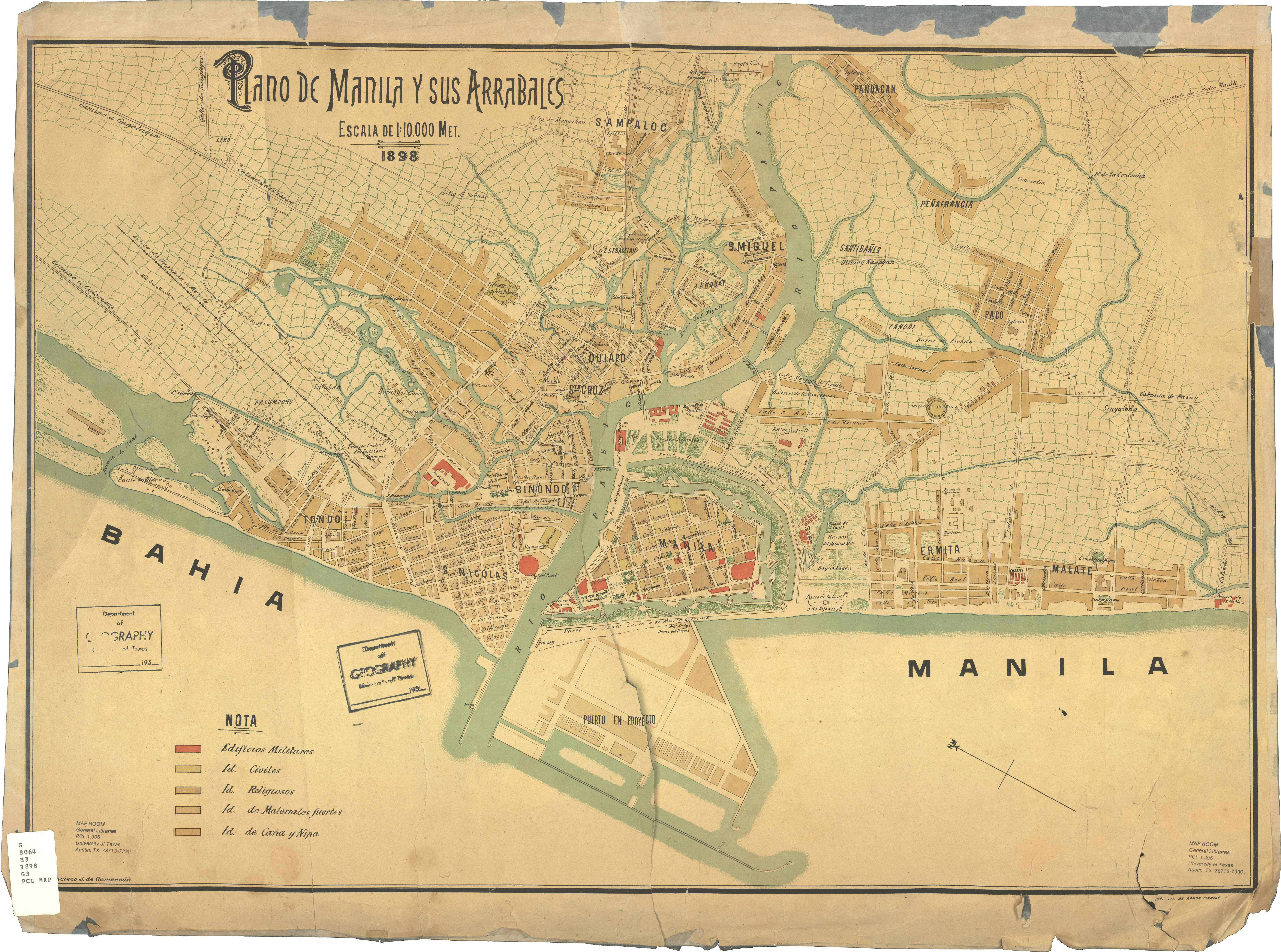
Consider this next case, of intelligence gathered by Filipino guerrillas, about Japanese positions in Intramuros. The map can be found in Corregidor: Then and Now Map Room.
First, you locate the area covered in Google Earth.
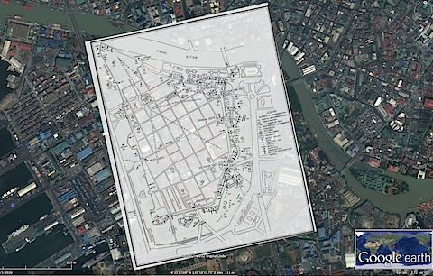
Next, overlaying the map, and some adjustments, leads to a pretty close correspondence between the map and the actual area it covers, when you overlay the map.
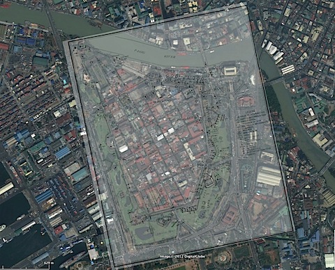
The result situates the map on Intramuros, and allows you to more fully imagine the information and area conveyed by the map.
After we launch our World War II in the Philippine project, we will be going on to doing a similar effort for the Revolution of 1896 and the Filipino-American War. This is another chapter in our history difficult for modern-dayy Filipinos to imagine and comprehend, because of how different the areas are now. Yet maps can help us visualize the Manila and the Philippines of our revolutionary generation.
Take this fine map of Manila, circa 1898, which can be found in the Perry-Castañeda Map Collection.
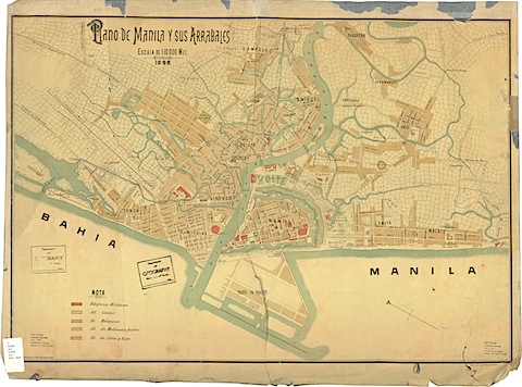
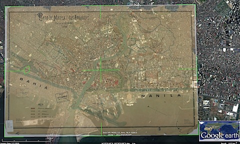
You can overlay the map on present-day Manila as follows:
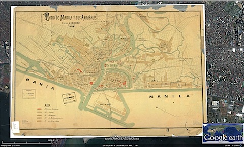
Though doing a semi-transparency is even more illuminating, immediately revealing, for example, how much closer to Intramuros the Manila Bay shoreline was, in 1898.
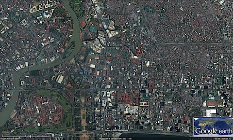
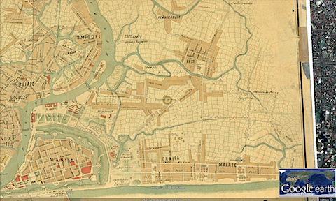
You can zoom in on areas in Google Earth, for example, focusing on the vicinity of San Miguel (upper third, where the bend of the Pasig River can be seen).
You can then see where this is in 1898:
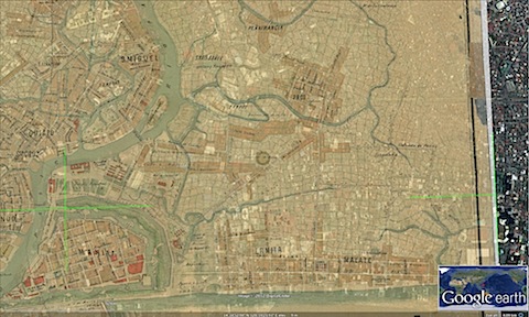
But again, a semi-transparency in overlay mode will reveal how the Pasig River has narrowed, where portions of the riverbank were reclaimed during the Commonwealth:
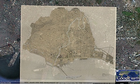
For an even more long-term project (once I talk to Paolo Alcazaren about his map collection), on past national capital plans for the Philippines, one can take a map like this, which is available on Wikimedia: the 1905 Burnham Plan for Manila.
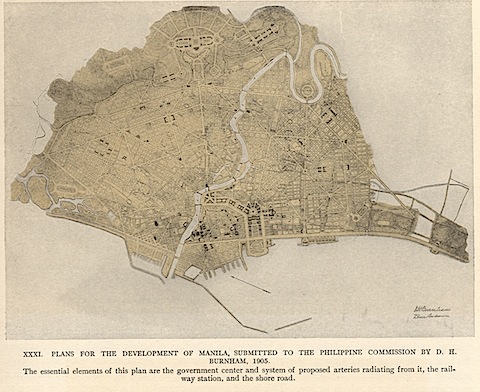
You can find the vicinity of Manila covered by the plan, in Google Earth:
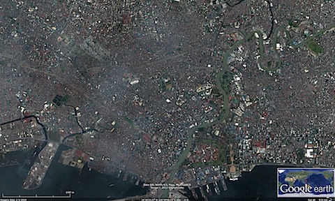
And overlaying the 1905 Plan on present-day Manila is pretty easy to do, after some adjustments:
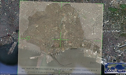
A semi-transparent overlay allows the viewer to compare and contrast the 1905 Burnham Plan, with present-day Manila, seeing which parts were accomplished, and which parts of the plan were not; and subsequent developments, including the prewar reclamation for the present-day U.S. Embassy, and postwar reclamation of land from Manila Bay.
For my next entry, an experiment with Google Street View will be next.