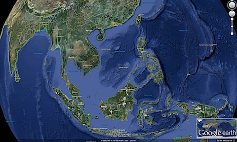
So we started off with overlaying historical maps on Google Earth. Let’s start this entry with our part of the world.
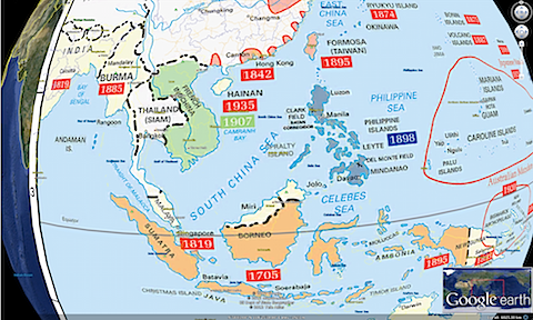
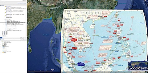
Let’s then take this map: The Imperial Powers in the Far East and Pacific, 1941 shared by the UNC School of Education and produced by the United States Military Academy, Department of History. Overlaying it on our part of the world turns a flat map, into something like this:
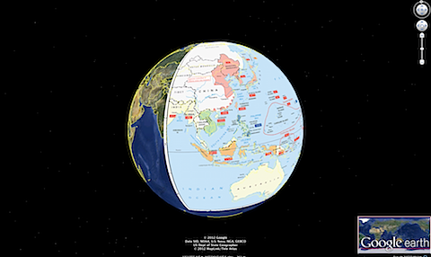
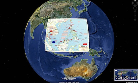
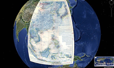
To more fully appreciate the scale of the actual map, and the part of the world covered, zooming out on Google Earth produces this breathtaking visual:
Or take this highly informative map, reproduced in the website of Ed Aragon: Japanese offensives in Dec. 1941 (source: United States Army Center of Military History). You can easily overlay it on Google Earth:
What overlaying does, is situate a historical map, on today’s globe, allowing you to situate the map, in turn, on the geography of the region.
On Wikipedia, you can find a scan of a map of Japanese POW Camps during World War 2. The map was published in January 1980 by the Medical Research Committee of American Ex-Prisoners of War, Inc. Only when you overlay it on Google Earth do you realize just how vast the scale of the map is –or the huge area in which POW camps were located.
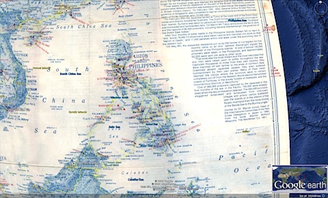
From there, the viewer can then zoom on particular areas, such as the Philippines. A certain amount of distortion is required, simply because a flat map of course approximates the areas which are really on the curved surface of the globe:
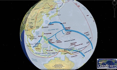
The breathtaking –and to me, educational– effect of overlaying 2D maps on a 3D surface is best seen by overlaying this map: The Pacific Theater, 1941-45 in the War in the Pacific National Historical Park site. The map portrays the island-hopping campaign of the Allies, on a truly epic scale. again, in a manner the original, flat, map simply couldn’t convey. It seems the best of both worlds: giving new life and meaning to an established map, and making it accessible using very friendly technology.
So from maps that focus on World War II in the Philippines, Google Earth is just as useful for visualizing maps that portray World War II in the Pacific. Next time, I’ll look at other resources that can also be used, including old city maps, and even archival photographs.
My hope is that the work of our team, when it goes online on April 9, the 70th Anniversary of the Fall of Bataan, can make maps and other historical resources, accessible to Filipinos, in visualizing and understanding World War II in the Philippines –and hopefully, make it possible for citizens to expand the project.